
Tahoe Maps by Tahoe Road & Trail Maps
MAP Desolation Wilderness and the South Lake Tahoe Basin by Tahoe Road & Trail Maps is a popular pick for fans of Lake Tahoe and beyond.
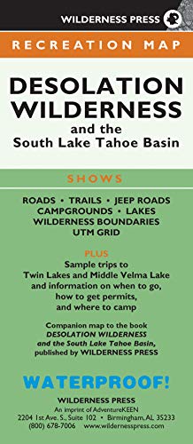
MAP Desolation Wilderness and the South Lake Tahoe Basin
Reg. Price: 12.95
Discounts or shipping charges may apply.

Available at Amazon
View more by
Tahoe Road & Trail Maps
About Tahoe High Sierra Shopping Links
The products featured in our online store are our handpicked list of items loved by Lake Tahoe fans. For details or to buy any item, click on the buy button to go to the sales fulfillment page, and you will be transported to Amazon, Sheet Music Plus or POND5 where the products are available for sale. We are an official participant in the these affiliate programs, such as Amazon Services LLC Associates Program, an affiliate advertising program designed to provide a means for us to earn fees by linking to Amazon.com and affiliated sites.