
Tahoe Maps by Tahoe Road and Trail Maps
Discover Lake Tahoe Basin Map US Forest Service National Geographic by Tahoe Road and Trail Maps for lovers of Tahoe High Sierra and beyond.

Lake Tahoe Basin Map US Forest Service National Geographic
Reg. Price: 12.60
Discounts or shipping charges may apply.

Offered by Natl Geographic Society Maps. Water Proof - Tear Resistant - GPS Compatible * Full UTM Grid*.
Lake Tahoe Basin [US Forest Service] (National Geographic Trails Illustrated Map - 803)
Waterproof - Tear-Resistant - Topographic Map
National Geographic's Trails Illustrated map of Lake Tahoe Basin delivers unmatched detail and valuable information to assist you in enjoying the year-round recreational opportunities this region offers. Expertly researched and created in partnership with local land management agencies, this map includes Desolation Wilderness; Prosser Creek Reservoir; Granite Chief and Mount Rose wilderness areas; and El Dorado, Humboldt-Toiyabe and Tahoe National Forests. In addition, the following state parks are included: Donner Memorial, Ed Z'berg Sugar Pine Point, Emerald Bay, D.L. Bliss, Lake Tahoe Nevada, Burton Creek, and Washoe Lake.
Item condition: NEW
Catalog Number:
1566953340
Amazon for delivery.
TahoeHighSierra Shopping by: Tahoe Road and Trail Maps
View more by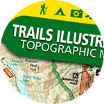
Tahoe Road and Trail Maps