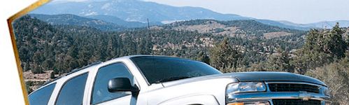
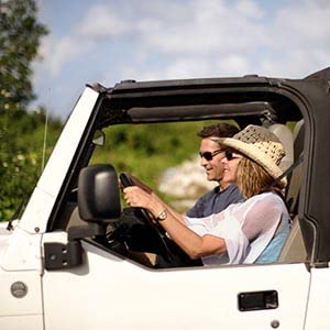
Off-Roading in the Lake Tahoe Area
Tahoe's Off-Road Trail Network is Gigantic and World Renowned!
With over 3/4 of the Lake Tahoe area designated for public use, off-roading opportunities are most everywhere. You can enjoy exploring the many ORV trails Lake Tahoe has to offer.
Here are some important resources for Off-Roaders...
Important Phone Numbers
- Foresthill OHV Area - Phone: (916) 478-6254
- Sierraville Ranger District - Phone: (916) 994-3401
- Nevada City Ranger District - Phone: (916) 265-4531
- Fordyce Jeep Trail - Phone: (916) 265-4531
- Truckee Ranger District - Phone: (916) 478-6257
- Downieville Ranger District - Phone: (916) 478-6253
- Prosser Hills Area - Phone: (916) 478-6257
Tackling Lake Tahoe's Off-Highway Vehicle Trails
The east shore of Lake Tahoe is located on the Nevada side along the west slope of the Carson Range. Access to this mostly undeveloped side of the lake is via Highways 50 and 28. Recreational opportunities found on the east shore include water activities, camping, hiking, horseback riding, downhill skiing/snowboarding, cross-country skiing and snowshoeing, and snowmobiling. Attractions include Cave Rock, Sand Harbor State Recreation Area, Spooner and Marlette Lakes, Nevada Beach, Zephyr Cove, and Round Hill Pines Beach, just to name a few!
- Genoa Peak Road 14N32 - Motorcycle, ATV, 4x4 9.5 mi.
- Kingsbury Stinger 18E39.3 - Motorcycle, ATV 2.8 mi.
- Logan House 14N33 - Motorcycle, ATV, 4x4 6.5 mi.
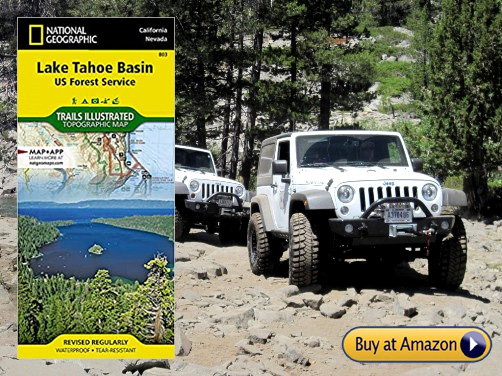
Lake Tahoe Trails Map
When you're out there, a trails map can be a valuable asset! U.S. Forest Service does a fantastic job on maps. So, be safe and have more fun exploring the Lake Tahoe area, by keeping a good map in your ORV at all times.
The north shore of Lake Tahoe is half and half, as follows. Half lies in California and the other half in Nevada. Access is via Highway 28, which stretches from Tahoe City, California to Incline Village, Nevada. The landscape also is half and half, half general undeveloped National Forest land and half developed urban areas. Recreational opportunities include water activities, camping, hiking, nearby downhill skiing/snowboarding, snowmobiling, cross-country skiing and snowshoeing. Attractions include Carnelian and Crystal Bays, Kings Beach State Park, North Tahoe Regional Park, and just a stone's throw away, Mt. Rose Wilderness.
- Kings Beach 18E18 - Motorcycle, ATV, 4x4 2.7 mi.
- Mt. Watson 73E - Motorcycle, ATV, 4x4 6.5 mi.
The south shore of Lake Tahoe is located on the California side of the lake with the main access via Highways 50 and 89. The south shore boasts a spectrum of commercial development intermixed with recreational opportunities that include water activities, camping, hiking, horseback riding, mountain biking, downhill skiing/snowboarding, cross-country skiing, snowshoeing, snowmobiling, hotels, restaurants, shopping, and gaming. Attractions include one the most photographed areas in the world, Emerald Bay and Vikingsholm Castle. On the south shore you will also find the Taylor Creek Visitor Center, Tallac Historic Site, Pope and Baldwin Beaches, Fallen Leaf Lake, Desolation Wilderness, Heavenly Mountain Resort and nearby Meiss Country.
- Corral Trail 18E14 - Motorcycle, ATV 1.5 mi.
- Hellhouse Road 12N01D - Motorcycle, ATV, 4x4 2.2 mi.
- High Meadows Trail 18E33A - Motorcycle, ATV 0.8 mi.
- Power Line Road 12N08 - Motocycle, ATV, 4x4 3.5 mi.
- Sand Pit 12N28 - Motorcycle, ATV 0.3 mi.
- Sawmill Pond 12N30 - Motorcycle, ATV 1.0 mi.
- Twin Peaks Trail 12N30 - Motocycle, ATV, 4x4 1.5 mi.
The west shore of Lake Tahoe is located on the California side of the lake. Highway 89 stretches along this side of the lake with access via Highway 50 to the south and Interstate 80 to the north. Recreational opportunities abound on the west shore where you will find water activities, camping, hiking, downhill skiing/snowboarding, cross-country skiing and snowshoeing. Attractions include nearby Palisades Tahoe, Alpine Meadows, Granite Chief Wilderness, Meeks Bay and Meeks Bay Resort, the Ehrman Mansion and access to the Rubicon Trail, one of the most popular OHV routes in the country.
- Buck Lake Road 14N40 - Motorcycle, ATV, 4x4 2.4 mi.
- McKinney/Rubicon Trailhead - Motorcycle, ATV, 4x4
- Noonchester 14N34A - Motorcycle, ATV, 4x4 2.65 mi.
Rubicon Trail: The Legendary Off-Road Experience at Lake Tahoe
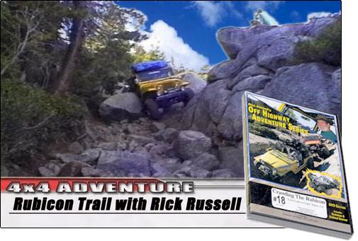
| 4 Wheeler's Guides to the Rubicon Trail 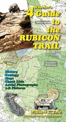
|
Not for beginners or low riders, but every Off-Roader needs to make a pilgrimage to ride on the 22-mile Rubicon Trail near Lake Tahoe's West Shore. Off-road enthusiasts flock to the Rubicon every year to earn bragging rights, so they can say they completed the Rubicon. Of the many events to take place on the Rubicon trail, the largest is the annual Jeep Jamboree CA. More than 35,000 vehicles finish it! You can too, if you and your vehicle are tough enough. |
Information about the Rubicon Trail from El Dorado County, California
Credit: Reprinted with permission by County of El Dorado
Location
The Rubicon Trail is located in the California High Sierra, due west of Lake Tahoe, approximately 80 miles east of Sacramento, and 35 miles east of Placerville. This world-renowned 4-wheel drive route leads from Georgetown (at California Highway 49) to Lake Tahoe (near Tahoma), a total distance of approximately 22 miles. The trail is a non-maintained County road located in El Dorado and Placer Counties. Parts of the trail pass through the Eldorado National Forest and portions of private lands.
Elevations run from approximately 5400 to over 7,000 feet (approximately 1,646 meters to over 2,134 meters). The section of road from Georgetown to Wentworth Springs (also known as the McKinney-Rubicon Springs Road) is a maintained road, while the off-highway vehicle (OHV) trail begins near Loon Lake. Most visitors begin the run from this mid-point, which is accessible off U.S. Highway 50. The portion of the trail from Loon Lake to Lake Tahoe is about 12 miles (19 kilometers) long and winds through the trees and rugged granite common to the area.
History
Originally a Native American trail connecting the Sacramento Valley and Lake Tahoe, the Rubicon Trail was re-discovered by European immigrants in the 1840s. By the 1890s, the trail had become an actual road (by the standards of the day) and was used to reach the Rubicon Mineral Springs Resort and Hotel. The first car into Rubicon Springs arrived in 1908, driven by a woman from Lake Tahoe. This historic drive received quite a bit of publicity from the San Francisco newspapers.
Throughout the 1920s, the Rubicon Springs road was being promoted as the best route from Georgetown to Lake Tahoe. To encourage travel along the route, a promotional automobile trip was organized, compete with photographs in the local papers. The write-up included mention of a survey party that would make plans for improving the road.
However, when the Rubicon Springs Hotel closed in the late 1920s, the road fell into disuse. The route has been used by 4-wheel drive vehicles since the early 1950s and has become one of the most famed, 4-wheel drive trails in the world.
The Current Trail
While the current trail travels the same route from Wentworth Springs to Rubicon Springs that has been used since the 1860s, it changes a little each season due to erosion and vehicle traffic. Many of the rock formations along the route are unique, allowing identification from historic photos of the original route which is crisscrossed in some areas by the 4-wheel drive road. The 4-wheel drive road also crosses a spillway built by PG&E in the 1930s and 1940s.
The Rubicon Trail is now widely recognized as the premiere OHV route in the United States and has been called the “crown jewel of all off highway trails.” At one time, it was revered as the most difficult, rated 10 on a scale of one to 10, due to its narrow passages, rocky climbs, and occasional mud hole. Because of its difficulty, the trail is recommended for short wheelbase vehicles with all skid plates in place.
The Rubicon Trail attracts both street legal and “green sticker” off-road motor vehicles. As a result, users travel the trail on and in wide range of all-terrain vehicles, including dirt bikes and a variety of 4-wheel drive vehicles, from street-legal SUVs to vehicles built for the sole purpose of driving the trail. Because the trail lies adjacent to the Desolation Wilderness, the Rubicon Trail is also used as an access route by hikers, backpackers, and fishers.
The ceremonial Rubicon trailhead is in Georgetown, a small community nestled on the western slopes of the Sierra Nevada Mountains in California’s Gold Country. The much of town’s economy is centered on servicing and supplying many Rubicon adventurers and their vehicles. The Rubicon Trail is normally run west to east (traveling east to west is referred to as “running backwards”). The western end of the Rubicon Trail has two trailheads. The true trailhead is located at the Wentworth Springs campground, while the more popular trailhead is at Loon Lake. These trails converge at Ellis Creek, approximately one mile from the start of each course.
The trail from the Wentworth Springs trailhead starts with an uphill climb. Once at the top, the trail levels out to a challenging drive to Ellis Creek. The trail from Loon Lake is more moderate. Beginning at the bottom of the spillway at the second dam, the trail passes through the Granite Bowl. It skirts Loon Lake on its way to Ellis Creek, where it joins with the Wentworth Springs section. From Ellis Creek, the trail winds through the trees on its way to Walker Hill.
Walker Hill is a challenging, uphill area that offers drivers a number of difficulties. This area contains three sections, each with its own challenge. First comes the lower, rock-strewn section, which makes a sharp turn to the right. Second is 100 feet (30 meters) of extreme trail that makes a turn to the left. Finally, you reach the third, upper section, referred to by some as the “sandstone section,” which is difficult terrain over decomposing rock. At the top of Walker Hill is a wide spot in the trail in a small grove of heavy timber. From here, the trail continues on toward the Little Sluice.
The Little Sluice is challenging and considered by many as the most difficult part of the Rubicon Trail. Though only about 100 feet (30 meters) long, it is heavily boulder-infested. Once through the Little Sluice, most drivers take a rest near Spider Lake (Spider Lake is closed to OHV access), a high mountain lake just above a low hill on the south side of the trail. From the Little Sluice and Spider Lake, the trail continues for approximately a mile to a granite shelf overlooking the Rubicon Valley and Buck Island Reservoir. At this point, the trail forks to the Granite Slab on the left and the Old Sluice on the right.
The Granite Slab route is more scenic and less time-consuming. It makes its way to the right and down the granite face of the mountainside, rejoining the Old Sluice fork approximately half a mile before the Buck Island Reservoir.
The Old Sluice route is more difficult, following a section of the historic Rubicon Trail that is often bypassed due to its difficulty. The route is fairly level along the mountainside, first reaching the short Chappie Rock drop-off. From here, the trail continues on its level path until reaching another small overlook. From this overlook, the trail begins a gentle, then steep, descent into the Old Sluice.
The Granite Slab and Old Sluice routes rejoin just past the bottom of the Old Sluice. From here, the trail crosses over the dam at Buck Island Reservoir. The trail then skirts the eastern edge of the reservoir and bears left, up, and over a low mountain pass before heading down to the Big Sluice.
The Big Sluice is another challenging section of the Rubicon Trail. Though misnamed (the Big Sluice traverses the side of the mountain rather than being walled on each side), this long downhill section offers rock after rock to crawl over.
After the Big Sluice, the trail crosses a bridge over the Rubicon River and heads down the Rubicon Valley. It passes through Rubicon Springs, continues on past the El Dorado County boundary line, and enters Placer County.
The Rubicon Trail is well maintained. As far back as 2009, El Dorado County with the assistance of California State Parks, Off-Highway Motor Vehicle Division Grant program implemented maintenance activities on the Rubicon Trail. The trail has also been surveyed and the trail location was adopted by the Board of Supervisors on January 26, 2010. El Dorado County, along with Rubicon Trail Foundation has developed trail markers, maps and educational materials to inform the public of the trail location. Law enforcement on the trail has increased in recent years to enforce all rules of the road.
Visitors to this page like...
Teltek USA Auto Thermometer
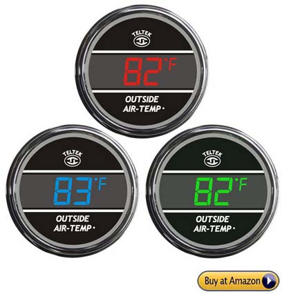
We learn a lot from our readers! This Teltek USA Auto Thermometer for Any Semi, Pickup Truck or Car is a popular choice for drivers in the know. The Truck and Auto Thermometer Gauge accurately displays the temperature inside or outside (one or the other) of your car, truck or semi. Users say, "It's USA made and extremely well built. It's very accurate and reliable for many years." Thanks for letting us know, because we got one on Amazon, and we have always been glad to have this Teltek Auto Thermometer for our RV. --Tom and Mary Kay
We hope you have enjoyed this page in our activities guide to Lake Tahoe, the High Sierras and Northern Nevada. We have enjoyed the trails at Tahoe and all over the High Sierras for many years! This is why we're super happy to tell you that this off-roading at Lake Tahoe page is our most popular page! Please support our Lake Tahoe website by patronizong our sponsors when looking for Tahoe lodging or other products. Thank you for visiting and enjoy your off-roading at Lake Tahoe and Beyond!