South Lake Tahoe Glitter and Grandeur
Where Both Worlds Meet
South Lake Tahoe has always felt like the perfect place where two worlds meet - the glitter and the grandeur. Just a few minutes from the bright buzz of Stateline's casinos, you can step from neon energy into alpine quiet and spacious scenery without missing a beat. Heavenly's slopes rise right above town, giving you that soaring, sky-high perspective, while the lake itself pulls you to its clear, beautiful blue depths with beaches and boating to explore. It's that blend - vibrant nights, mountain air, and the calm blue waters - that makes South Lake Tahoe feel like a place you don't just visit, but joyfully experience on every level.
South Lake Tahoe is the lively heart of the region, a blend of lakefront beauty, mountain adventure, and the bright lights of Stateline's casino corridor just steps across the Nevada border. Here, rustic cabins and family-run motels sit alongside high-rise resorts, restaurants, and entertainment venues. Whether you are here for outdoor fun or a night on the town, South Lake Tahoe has a little of everything.
Sunshine Wear for Your Tahoe Visit

Headed for South Lake Tahoe? This summer themed tank dress for women is perfect for vacationing at Lake Tahoe. This sleeveless "Tank Top Dress" is soft, lightweight and loose fitting to wear all summer long. It's a super attractive and cute vacation outfit.
Paddlewheelers and Beaches
Yet, amidst the glitz, there are many ways to experience the lake. Join sunbathers and swimmers at Regan Beach. Ride the tram up the slopes to the top of Heavenly ski resort where you will be greeted by expansive views of Lake Tahoe and surrounding mountains. Or, take a trip aboard the MS Dixie II, a paddlewheel boat that departs from Zephyr Cove in Nevada, just north of South Lake Tahoe. To find these attractions, resort concierges can point to the free shuttle or help you book other lake cruises.
Emerald Bay
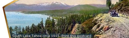
Traveling west from the lively shoreline town of South Lake Tahoe, the lake shines it's impossible shade of blue, and the shoreline fills with bike paths, lodges, a few less restaurants, smaller motels, where the pine trees stand tall, and the whole scene seems to say, "Get ready, there is a lot to explore," as we leave the bustle of town.
On the shoreline to the west you will find one of the most photographed places in the Sierra, Emerald Bay State Park. Only ten miles from town, it feels worlds away. Paved walking and biking paths lead you along the shore, and tall pines frame views that belong on a postcard. Parking areas and campgrounds make it easy to spend a full day exploring.
Emerald Bay to the west along the shoreline, is part of a stunning 1,830 acre state park with rocky coves, sandy beaches, picnic areas, and miles of hiking trails. The forests here are a mix of Ponderosa and Jeffrey pines, red and white fir, cedar, juniper, cottonwood, and the famously twisted sugar pines that cling to the granite slopes. A short walk along the Balancing Rock nature trail brings you to a 130 ton boulder perched improbably on a narrow stone pedestal, a favorite sight since the 1800s.
From Emerald Bay, you can begin a scenic drive around the lake. Head north along the West Shore and you will reach Vikingsholm, a remarkable Scandinavian style castle tucked into the forest. It is open for tours in summer (a small fee applies).
Continue two miles farther to Sugar Pine Point State Park, home to the historic Ehrman Mansion. Decorated in 1930s furnishings, the estate sits on expansive lakefront grounds that may look familiar if you have seen the movie The Godfather Part II.
The full 75 mile loop around Lake Tahoe is often called one of the most beautiful drives in America, and once you have done it, you will understand why.
Living in South Lake Tahoe
The eastern edge of South Lake Tahoe blends seamlessly into Stateline, Nevada, where shops, restaurants, hotels, and the Heavenly Village area create a lively hub for visitors. The casinos sit just across the border, an easy way to tell which state you are in when the line between the two communities becomes hard to spot.
South Lake Tahoe stretches about five miles west along Highway 50 (Lake Tahoe Boulevard). The western side of town is quieter, with residential neighborhoods and vacation rentals clustered around "The Y," the intersection of Highway 50, Highway 89, and Lake Tahoe Boulevard. Here you will find outlet stores, cafes, and the local bus terminal with service to and from Sacramento.
The city covers 16.5 square miles, with nearly 40 percent of that area made up of water. At an elevation of 6,260 feet, the air is thin and the sun is strong, so drink plenty of water and take your time on stairs and trails. Visitors with heart or respiratory conditions may find the altitude challenging, so a slower pace is always a good idea.
South Lake Tahoe is part of the Sacramento-Arden-Arcade-Roseville Metropolitan Statistical Area.
Interesting Stats About South Lake Tahoe
-
Country: United States
State: California
Land Area:
- Total: 16.5 sq mi (42.7 km2)
- Land: 10.1 sq mi (26 km2)
- Water: 6.4 sq mi (16.7 km2)
Elevation: 6,237 ft (1,901 m)
Population:
- Total: 21,186
- Density: 1,430.8/sq mi (552.9/km2)
Time zone: Pacific (PDT) (UTC-8)
- Summer (DST): PDT (UTC-7)
ZIP code: 96150
Area code(s): 530
FIPS code: 06-73108
GNIS feature ID: 1659822
South Lake Tahoe is a city in El Dorado County, California, nestled high in the Sierra Nevada Mountains.
Show Your Tahoe Spirit