Lake Tahoe Mountain Biking > Trails & Reviews

Lake Tahoe is a Mountain Biking Mecca
Let's start our Lake Tahoe Mountain Biking page with this article from Winter Mountain Biking Guide reprinted courtesy of Taylor Flynn's Tahoe Mountain News and updated by TahoeHighSierra.com. An avid mountain bike rider, Taylor loved to ride the trails and share his knowledge.
Fat Tire Meca Awaits Mountain Bikers by Taylor Flynn
With famous trails like Mr. Toads Wild Ride, the Flume Trail, and the Tahoe Rim Trail, Lake Tahoe is renowned for outstanding mountain biking. The following guide will lead you to these and other well-known mountain bike routes on and around Lake Tahoe. Starting with easier rides and progressing to more difficult ones, this guide is designed to provide something for everyone. Route directions are suggestions only, and many trails have multiple variations and connections with other routes.
South Lake Tahoe > South Lake Tahoe City Bike Path
This paved bike path is a real asset to the town of South Lake Tahoe. The trail is separated from the highway and winds through pine trees for several miles, keeping you away from busy roads and taking you past scenic meadows and quiet neighborhoods. The mostly flat path is ideal for commuting, cruising to the beaches, or enjoying a relaxed family ride.
The paved path connects mid-town South Lake Tahoe to the U.S. Forest Service bike path along Emerald Bay Road (Highway 89). This section, often called the Pope-Baldwin Bike Path or Forest Bicycle Trail, parallels the road and provides access to popular beaches such as Pope and Baldwin, the restored Baldwin Estate, and the Forest Service Visitor Center.
This is a beautiful and fun trail for cycling with family or your favorite
riding partner. Seasonal bike rentals are often available near Emerald Bay
Road, and there are several places along the way to stop for food, drinks,
or even ice cream at nearby resorts and cafes.
Technical: Easy
Climbing: None to very little
South Lake Tahoe > Fallen Leaf Road
Though this is a paved road with vehicle traffic, youll be glad youre on a mountain bike or sturdy hybrid on this narrow, bumpy two-lane route. Fallen Leaf Road leads through shaded evergreen forests, along lush green meadows, and eventually flanks the southeastern shoreline of Fallen Leaf Lake. If youve never seen this pristine alpine lake nestled at the foot of 9,735 ft Mt. Tallac, this ride is a must-do.
With just a couple of gradual hill climbs on this roughly 4-mile ride (8 miles round trip), you get a lot of scenery for your effort. An extra quarter-mile beyond Fallen Leaf Lodge brings you to Glen Alpine Falls, a beautiful bonus stop.
How To Get There: From South Lake Tahoe, head north on
Highway 89 about one mile past Camp Richardson. Fallen Leaf Road is on the
left and can be easy to miss. Park in the turnout near the intersection, or
access Fallen Leaf Road from the Forest Service bike path on the lake side
of Highway 89.
Technical: Easy
Climbing: Minimal
Where to get Lake Tahoe mountain bike trails maps...
Even though most riders use GPS to find their way around the trails, a paper map is always a good idea. That's because cell service can be unreliable in the mountains. And, paper has no need for batteries that sometimes die at just the wrong time. The US Forest Service and Nevada State Parks publish maps for Lake Tahoe mountain bike riders. When you are out on the trail, a hard copy topo map is reliable and great to take along.
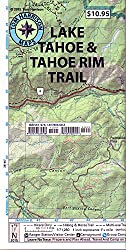
Tahoe Mountain Bike Trails Map
South Lake Tahoe > Nevada Beach Loop
Much of the terrain around Kingsbury Grade in Nevada is steep, but there is a family-friendly loop that links paved paths, quiet roads, and lakeshore riding near Nevada Beach. This loop is great for riders looking for a mellow outing with forest scenery and beach access rather than big climbs.
How To Get There: From the Stateline casinos, drive east to Kingsbury Grade and turn right. Park near Kahle Park or nearby public parking areas. Local bike shops in the area can provide maps and current route suggestions.
The Ride: From Kahle Park, follow the paved bike path that
begins just behind the park. It leads into the forest and across a series
of small ravines for about 3 miles to Elks Point Road. Turn left and continue
through the intersection toward Nevada Beach. Cruise the beach path and nearby
roads, then loop back toward your starting point using the bike path or quiet
neighborhood streets.
Technical: Easy
Climbing: Very little
South Lake Tahoe > Angora Lakes
This is a solid, steep hill climb with a pot of gold at the top: crystal-clear alpine lakes surrounded by cliffs, a small resort area, and famously refreshing lemonade. Angora Lakes is a classic South Shore destination and a rewarding ride for those who dont mind some climbing.
The Ride: From Highway 89, ride Fallen Leaf Road for about
1.5 miles and turn left onto Tahoe Mountain Road. After a short climb, turn
right on Angora Ridge Road. The partially paved road climbs steeply for roughly
1.5 miles to a fire lookout with excellent views of Lake Tahoe and Fallen
Leaf Lake. From there, the road descends to a parking area. A short trail
(about 1/8 mile) leads up to Angora Lakes, roughly 5 miles from Highway 89.
Technical: Low
Climbing: A lot
South Lake Tahoe > Powerline Trail
The Powerline Trail does not climb far above lake level, but that doesnt mean its flat. Running roughly parallel to Pioneer Trail (road), Powerline is a 7-mile series of short ascents and descents as it crosses several ravines and creeks, including Trout Creek, Cold Creek, and Heavenly Valley Creek. The ravines and climbs are tremendous fun, especially near the base of Heavenly Mountain Resort, where the terrain becomes more rolling and playful.
The Ride: Start from either Oneidas Street or the end of
Elks Club Drive (often called Garbage Dump Road) off Pioneer Trail. Head east
along the double-track service road under the power lines, which also serves
as an off-highway vehicle (OHV) route. The OHV road ends at Cold Creek, where
a singletrack trail continues behind the Montgomery Estates neighborhood and
eventually reaches Ski Run Boulevard near the California base area of Heavenly.
Technical: Some technical sections
Climbing: Frequent short climbs
Top Gear Picks for a Lake Tahoe Mountain Biking Adventure
If you're gearing up for a mountain biking adventure at Lake Tahoe, the essential purchases fall into a few clear categories: safety gear, hydration, repair tools, and trail-ready clothing. Below is a curated list of top products shown with live shopping options to help riders prepare confidently for Tahoe's rugged, high-altitude terrain.
1. Hydration Pack (CamelBak)

A lightweight, reliable hydration pack ideal for Tahoe's high elevation and long trail days. Find on Amazon...
2. Mini Hand Pump

A compact, durable mini pump perfect for on-trail tire fixes in remote areas. Find on Amazon...
3. Multi-Tool (Crankbrothers)

A versatile multi-tool with many functions, ideal for quick adjustments and repairs. Find on Amazon...
4. Arm Sleeves Tahoe Style

Protect your arms from Tahoe's intense sunlight and be trendy too, when you wear these Tahoe image arm sleeves. Find on Amazon...
South Lake Tahoe > Corral Loop
The Corral Loop is a favorite among South Shore mountain bikers and trail runners. One of its advantages is the combination of a paved climb and a dirt, singletrack descent. It feels like you get a lot of fun downhill for the effort you put into the climb. The descent is fast, flowy, and includes a few technical rock and root sections, plus optional features built and maintained with the help of local trail groups.
The Ride: From Pioneer Trail, take Oneidas Street and follow
the paved but lightly traveled road several miles up a steep climb. About
50 yards past the bridge over Trout Creek, look for a turnout and trail marker
on the left. The singletrack climbs briefly, then descends through sandy and
rocky sections before opening into twisting, fast turns. The trail ends at
the Powerline Trail, where you can turn right to continue exploring or left
to return toward Oneidas Street.
Technical: Moderate technical fun
Climbing: Yes
South Lake Tahoe > Mr. Toads Wild Ride (Saxon Creek Trail)
Heres the ride youve been looking for. Named after the Disneyland roller coaster, Mr. Toads Wild Ride is notorious for its long, rocky descent, banked turns, and thick forest. Once an obscure OHV route known as the Saxon Creek Trail, it has become South Shores most famous mountain bike trail and a true Tahoe classic.
In recent years, the Tahoe Area Mountain Biking Association (TAMBA) and volunteers have invested significant time and resources into restoring and improving the trail. Rock armoring, drainage work, and careful reroutes have helped repair eroded sections and preserve the character of the original singletrack while making it more sustainable for future use.
The Wild Ride: Start from the Big Meadow Trailhead (parking
and restrooms) off Luther Pass on Highway 89. Ride the Tahoe Rim Trail east
for about 3 miles on gorgeous, technically challenging singletrack to Tucker
Flat. Turn left at the Saxon Creek Trail marker and get ready for a serious
descent. For roughly 4.5 to 6 miles (depending on your route), its mostly
downhill, with rocky drops, tight turns, and fast, flowing sections. Wildflowers,
streams, and meadows add to the scenery along the way.
Technical: Advanced, very technical in places
Climbing: Significant if ridden as a loop via the Tahoe Rim
Trail
TahoeHighSierra.com Hot Trail Tip: You can return to your
car by climbing back up, or you can turn the ride into a larger loop. One
popular option is to continue down to the neighborhoods near Oneidas Street,
then use Pioneer Trail, Highway 50, and the Meyers bike path to reach South
Upper Truckee Road. From there, ride through Christmas Valley and up the old
Luther Pass Road to reconnect with Highway 89 and the Big Meadow Trailhead.
A good street map and Forest Service map (or a reliable GPS app) are highly
recommended for planning this extended route.
Technical: Lots of technical riding
Climbing: Lots of climbing on loop options
Tahoe Mountain News & Tahoe Mountain Visitor Reprinted with Permission © 1999 Updated: 2003-2026 by TahoeHighSierra.com
High-Altitude Sun Protection for Tahoe Riders

Lake Tahoe sits at over 6,000 feet, where the sun is stronger and the air is drier. Mountain bikers quickly discover that high-altitude UV exposure can be intense, even on cooler days. A good sport sunscreen, SPF lip balm, or lightweight sun sleeve can make a huge difference in comfort and safety on long rides. Check out the top-rated sun protection options for riders heading into Tahoe's high country.
North Lake Tahoe > Tahoe XC > Trails & Rentals
Located in Tahoe City, California, Tahoe Cross Country (Tahoe XC) offers access to miles of scenic summer hiking and biking trails that wind through Burton Creek State Park and the surrounding forest. The terrain ranges from mellow meadows to rolling singletrack, making it a great destination for hikers, runners, and riders of all levels.
Tahoe XC's trailhead sits on Tahoe City Public Utility District land and serves as a gateway to quiet forests, wildflower meadows, and viewpoints overlooking Lake Tahoe. While Tahoe XC's primary focus today is winter Nordic skiing and community programs, the trailhead remains a popular summer access point for outdoor enthusiasts.
Food and retail services vary seasonally, so visitors should plan to bring water, snacks, and any gear they need for the day. The lodge is currently part of a long-term redevelopment project, but the trail system remains open and well-loved.
After your adventure, Tahoe City's shops and cafes are just minutes away for a cold drink, ice cream, or a well-earned meal.
Visit TahoeXC.org for current details...
North Lake Tahoe > Spooner Lake State Park > The Flume Trail

Mountain Biking the Iconic Tahoe Flume Trail
This is the ride you've seen in all the brochures -- sweeping views, dramatic cliffs, and that classic ribbon of singletrack carved into the mountainside. The Flume Trail remains one of the most photographed and celebrated rides in the Sierra.
Starting at Spooner Lake
Begin at Spooner Lake Nevada State Park, located at the junction of Highway 50 and Highway 28.
- Fees: State park entry fees apply for parking and trail access.
- Climb: The route follows North Canyon Road, a double-track dirt road that winds through aspen groves before steepening toward Marlette Lake.
The ascent is steady and can feel challenging for newer riders. A short, sandy "granny gear" section near the top still catches many visitors by surprise -- walking it is common and nothing to be ashamed of.
Marlette Lake to the Flume
At Marlette Lake, follow the dirt road along the shoreline to Marlette Dam. From here, the historic flume grade becomes a narrow singletrack etched into the mountainside. The trail is nearly flat and endlessly scenic, with Lake Tahoe shimmering about 1,000 feet below. Despite the exposure, the tread is wide enough for most riders to feel comfortable.
Descent to Incline Village
The Flume Trail eventually meets a dirt road that drops steeply for about 3 miles into Incline Village. The sandy descent is fast, loose, and memorable -- and you'll be glad you're going down, not up.
The trail ends near Highway 28 on the East Shore. From here, riders can:
- Pedal back to Spooner Lake on pavement, or
- Use a shuttle service (typically operated by Flume Trail Bikes in Incline Village) to return to the start.
Technical: Intermediate to advanced
Elevation: approx. 7,000-8,000 ft
Climbing: approx. 1,100 ft
Distance: approx. 20 miles (varies by route)
Water: Available at Marlette Lake (filter required)
Safety: Bring plenty of water, a pump, spare tube, and sun
protection. Afternoon thunderstorms and wildfire smoke are common in summer.
Bicycle Rentals & Shuttles near Spooner Lake State Park
Nevada State Parks has partnered with various concessionaires over the years, but bike rentals at Spooner Lake are not consistently available today. Most riders rent bikes or arrange shuttles through businesses in Incline Village, such as Flume Trail Bikes, which typically offer:
- Mountain bike rentals
- E-bike rentals (note: not all trails allow e-bikes; check regulations)
- Shuttle service to Spooner Lake or Tunnel Creek
Always check current availability and operating hours before planning your ride.
North Lake Tahoe > Tahoe Rim Trail > Tahoe Meadows
Tahoe Meadows to Tunnel Creek: A Local Favorite
This section of the Tahoe Rim Trail is one of the most beloved routes in the entire region. With panoramic views of both Lake Tahoe and Carson Valley, gentle rolling terrain, and a mix of meadows and ridgelines, it is a rewarding outing for riders and hikers alike.
Trail Access
The trailhead is located along Mt. Rose Highway (Hwy 431), about one mile south of the summit.
- Parking: Free but often crowded, especially on weekends.
- Facilities: A small interpretive area exists, but there is no full visitor center.
Bike Access Rules
This section of the Tahoe Rim Trail is open to mountain bikes on:
- Even-numbered calendar days only
Hikers are welcome every day. The system works well, and trail users generally share the space respectfully.
Trail Description
The first mile and a half climbs gently through open meadows. After that, the trail rolls along the crest of the Carson Range with:
- Occasional rock steps
- A few switchbacks
- Long stretches of smooth singletrack
- Constant views in every direction
It is suitable for beginners with some fitness, but still fun for experienced riders who want to push the pace.
Route Options
At about 9 miles, the trail reaches the intersection with Tunnel Creek Road. From here you can:
- Continue south toward Marlette Lake and Spooner Lake, or
- Turn down Tunnel Creek Road for a sandy, steep descent to Highway 28 on the East Shore.
Either way, you will end up near the lake and can return via shuttle or by climbing back to Tahoe Meadows.
Technical: Easy to intermediate
Elevation: approx. 7,000-8,000 ft
Water: None on trail; water at Marlette Lake requires filtering
Best for: Scenic rides, family outings, and anyone who wants
big views without brutal climbing.
Reviews of Tahoe Rim Trail
 Rim Trail and Mt. Tallac
5 of 5 stars
The Rim Trail offers the most beautiful experience of all, and it encircles Lake Tahoe. There are many trailheads to start from. We did Tahoe Meadows, Mt. Rose Summit and Mt. Tallac. Mt. Tallac being the most strenuous of them all. Very steep at times but the view from the top is worth every step of the way. Plan on about 6 hours for Tallac, depending on your fitness for altitude and the pace you choose to go.
Stunning Scenery
Easy to get lost - 4 of 5 stars
We rode different trails and very little is marked. So at times it was hard to know which way to turn. One sign post had been knocked down. But that is part of the adventure! Fortunately Village Ski and Bicycles in Incline Village has a website with maps... Strenuous ride. Guaranteed to go uphill a few miles...
Experience Tahoe Rim Trail
4 of 5 stars
I have section-hiked and biked the Tahoe Rim Trail, mostly day trips, but with some overnighters and one several-day trip through the Desolation Wilderness. The whole trail can be done as day hikes with some planning and car shuttles. Beautiful, sometimes crowded, especially on the sections that allow mountain bikes. Water sources can be a problem, especially on the East side and following poor winters. The Tahoe Rim Trail Association maintains a website that is loaded with information. Any trip to Tahoe should include at least one experience on the Rim Trail.
Guide to the Tahoe Rim Trail
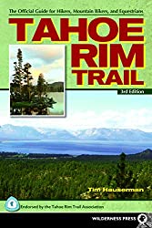
Locals all know the author of this Tahoe Rim Trail Guide! It's Tim Hauserman, and Tim has been hiking, skiing and riding the trails at Lake Tahoe all his life. So when he authored this guide to the Rim Trail, we expected it would be exceptional. And we were right! -- Tom and Mary Kay
Tahoe Rim Trail Guide by Tim Hauserman
Start at FREE USFS Parking
The Rim Trail is a lot of fun...
...whether you hike, run, mountain bike or cross country ski. And it is FREE! The Mt. Rose Meadows parking lot is FREE. But you should know that you can also park for FREE at the US Forest Service parking lot on Spooner Summit. There are other NOT FREE parking lots run by the State of Nevada and you can save money by finding the USFS lot.
Go to Spooner Summit on Hwy 395 and look for the lot on the south side of the highway. There are shade trees and restrooms at this lot too. The parking spaces are wide and laid out very well. You can start your trip on the Rim Trail from here heading south or north. To go north, you just need to walk across the highway.
News About This Tahoe High Sierra Page
Thanks live555 Tahoe Mountain Bike Page for Liking this Tahoe Mountain Biking Page!
4/12/2018 Many thanks for recommending Tahoe High Sierra as a great resource for mountain bike trails at Lake Tahoe!
Do you have a website that loves Lake Tahoe Reno and Mammoth?
Link to us and then click on our contact link, to receive our Thanks Link on a page on our site!
More Tahoe Activities: Off-Roading
|
|