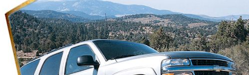
Off-Roading in the Lake Tahoe Area
Tackling Lake Tahoe's Off-Highway Vehicle Trails
Tahoe's Off-Road Trail Network is Gigantic and World Renowned! With more than three-quarters of the Lake Tahoe Basin designated for public use, off-roading opportunities are abundant. The region offers an extensive network of OHV trails that let you explore forests, ridgelines, and rugged Sierra terrain. This page highlights many of the most interesting off-roading opportunities at Lake Tahoe, especially routes we have experienced and enjoyed.
Get a
Lake Tahoe Trails Map
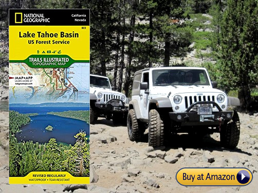
Paper is Reliable
A high-quality trails map is an essential tool when exploring the backcountry. Even if you have GPS, cell service can be unreliable in the mountains. Plus, paper maps do not rely on batteries that sometimes die just when you really need them. The U.S. Forest Service produces excellent maps that help you stay oriented and safe. Keep a reliable map in your OHV at all times.
Lake Tahoe South & East Shore OHV Trails
The east and south shore of Lake Tahoe lies on the Nevada side along the west slope of the Carson Range. Access is via Highways 50 and 28. It's mostly undeveloped shoreline offering outdoor recreation. Some OHV opportunities here are...
Genoa Peak Road 14N32
Genoa Peak Road is a favorite off-road route of ours, and we have ridden, run and hiked this road many times. Below is a map that you can enlarge and zoom, to see exactly where the route goes. It's a Google map, so you may need to adjust your browser or network settings to view. To enlarge this map to full screen, click on the little box icon in the header.
This is an especially great Motorcycle, ATV and 4x4 trail (9.5 mi.) This US Forest Service road traverses the Carson Range from north to south and can be reached from Kingsbury Grade on the south end or Spooner Summit to the north. By zooming in on the above map, you can see the roads mentioned in our directions presented below.
The Spooner Summit area on Highway 50 offers excellent access to Genoa Peak Road. The OHV trailhead is located right at the top of Spooner Summit on Highway 50, just before the highway makes a "Y" to go to North Lake Tahoe or Carson City. As you approach the "Y" at the summit, look for the parking lot on the right side of the road. The dirt lot provides direct access to the motorized trails that head uphill.
Spooner Summit Trailhead for Genoa Peak
When you park at the Spooner Summit OHV access point, the trail ascends to the ridge above Lake Tahoe. Then, the motorized route extends along the spine of the ridge, with side trails branching toward viewpoints, forest clearings, and connecting roads. The main OHV corridor generally follows the high ground between Spooner Summit and the areas above Kingsbury Grade to the South, offering long stretches of open terrain and panoramic scenery.
Riders often air down slightly for better traction on decomposed granite surfaces. Carry extra water, because the high elevation and dry air can dehydrate you quickly and there is no water along the way. The trails are shared-use, so you will be sharing with hikers, mountain bikers and other off-roaders.
Because Spooner Summit sits above 7,000 feet, snow can linger well into spring. Many of the motorized routes remain inaccessible until early summer, depending on the winter snowpack. Fall is often the best season for off-roading at Lake Tahoe, with cooler temperatures and clear views. Before you go, it's important to check current conditions and any temporary closures issued by the Lake Tahoe Basin Management Unit, because trail access can change due to weather, fire restrictions, or maintenance work.
Kingsbury Grade Access to Genoa Peak Road
To access Genoa Peak Road from the south near the Stateline, Nevada casinos and Heavenly Valley Ski Resort, OHV access road at the top of Kingsbury Grade is Andria Drive. When you reach the summit of Kingsbury Grade (NV-207), turn north on N. Benjamin Dr. This street becomes Andria Dr. which you follow to the end, where the trailhead sign will be on your left, next to the paved parking area. This is the staging area for dirt bikes and ATVs as well as hikers and mountain bike riders. From this trailhead, riders park, unload, and head out to trail riding fun. The staging areas work well, but space can be limited on busy weekends. Cell service is generally good near the summit but becomes unreliable as you move deeper into the mountains, so download maps in advance if you depend on GPS navigation
Where the Road Goes
From Kingsbury Grade, the road climbs toward Genoa Peak and continue along the ridge system that stretches north toward Spooner Summit.
Seasonal Access
This Genoa Peak Road sits around 7,400 feet, so snow can linger into late spring on the higher routes. Many of the ridge trails do not fully open until early summer, depending on the winter snowpack. Fall is often the best season for this trail, with cooler temperatures and clear visibility. Always check current conditions and any temporary closures from the Lake Tahoe Basin Management Unit, because access can change due to weather, fire restrictions, or maintenance work. More info: US Forest Service Genoa Peak Road Page
Great Tahoe Wear for Your Tahoe Adventures

Shop our Tahoe High Sierra store for Tahoe Wear: T-Shirts and other Tahoe branded favorites for your Off-Roading at Tahoe. Browse our handpicked selection of items for Lake Tahoe fans like you.
More Popular South Lake Tahoe OHV Trails
Here is a list of more popular off-roading near South Lake Tahoe. You can find these roads by their #, such as 12N01D, by zooming in on the Lake Tahoe area of the US Forest Service interactive map.
Hellhouse Road 12N01D
This 2-mile route is classified as a "Moderate/Easy" trail used for recreation.
Key Details
Location: South Lake Tahoe, El Dorado County.
Type: OHV Route / Forest Service Road.
Length: Approximately 2 miles.
Driving Directions
From South Lake Tahoe: Head south on CA-89 S (Lake Tahoe Blvd) toward Meyers.
Turn onto Pioneer Trail: If coming from the "Y", turn left onto Pioneer Trail.
If coming from Stateline, turn right onto Pioneer Trail.
Oneidas Street: Turn onto Oneidas Street (off Pioneer Trail).
Fountain Place Road (12N01): Follow Oneidas Street as it turns into Fountain
Place Road.
Locate the Trail: Continue up Fountain Place Road for several miles. Hellhouse
Road (12N01D) is a spur road branching off the main system.
Power Line Road 12N08
Short but useful because it connects many other trails. It typically begins
at the end of Saddle Road in South Lake Tahoe and runs from the Railroad Grade
Trail to the High Meadow Trail.
Length: 2.5 miles.
Difficulty: Moderate with a few steep sections.
Driving Directions
From US-50: Approximately 5 miles west of South Lake Tahoe, turn left (east)
onto Pioneer Trail.
To Oneidas Street: After 0.8 miles, turn right onto Oneidas Street.
Fountain Place Road (12N01): Follow Oneidas Street as it becomes Fountain
Place Road.
Reach the Junction: Drive past the Corral Trail staging area. Continue to
the junction where Power Line Road (12N08) begins.
More info: A map & description of Power Line Road 12N08
Sand Pit OHV Area 12N28
Motorcycle, ATV, OHV, 0.3 miles. A small, seasonal OHV spot directly across from South Tahoe High School off Lake Tahoe Boulevard. Offers open-area riding and trail riding.
More info: USFS page for Sand Pit OHV Area 12N28
Twin Peaks Trail 12N30
Motorcycle, ATV, OHV, 1.5 miles. Near Sawmill Pond and operated by the US Forest Service. A popular, seasonally accessible multi-use trail for OHV and mountain biking.
Driving Directions
Start on US-50: Head south on US-50 for approximately 3 miles.
Turn onto Sawmill Road: Turn right (west) and continue 1.8 miles.
Locate the Staging Area: Turn right toward the Sawmill Pond/Twin Peaks Staging
Area.
More info: USFS page for Twin Peaks Trail 12N30
Lake Tahoe North Shore OHV Trails
The north shore of Lake Tahoe spans both California and Nevada. Access is via Highway 28 from Tahoe City to Incline Village. Here you will find National Forest land mixed with developed communities. Opportunities for off-roading are...
Kings Beach 18E18.2 (Chipmunk)
Motorcycle, ATV, 4x4, 2.7 miles. Easy road suitable for 4-wheel drives and
high-clearance vehicles. Located near the Coon St. area in Kings Beach.
View the Tahoe
National Forest online map or download
USFS MVUM maps.
Driving Directions
From Truckee: Take Hwy 267 South about 10 miles.
Turn left (east) onto Forest Service Road 16N52 and follow it toward the trailhead.
Mt. Watson 16N50
Motorcycle, ATV, 4x4, 6.5 miles. Accessed from the North Shore near Tahoe City.
Driving Directions
From Truckee:
Take I-80 to Exit 188B.
Turn right onto Hwy 267 South for 8.5 miles.
Turn right onto Mt. Watson Road (Fibreboard Freeway) for 6 miles.
Turn left onto Forest Service Road 16N50 for 0.5 miles to reach the trailhead.
Lake Tahoe West Shore OHV Trails
The west shore of Lake Tahoe is on the California side, accessed via Highway 89. Here is where you will find access to the world-famous Rubicon Trail and more.
Buck Lake Road 14N40
Motorcycle, ATV, 4x4, 2.4 miles. Rated Difficult. Accessible via the Rubicon Trail.
Driving Directions
Staging Area: Tahoma staging area (McKinney/Rubicon Trailhead).
Enter the Rubicon Trail from the large parking area.
Drive 0.5 miles and turn north (right) onto Buck Lake Road 14N40.
McKinney/Rubicon Trailhead
Motorcycle, ATV, 4x4.
Driving Directions
From Highway 89: In Tahoma, turn west onto McKinney Rubicon Springs Road.
Navigate the neighborhood via Bellevue Avenue and McKinney Road.
Continue straight at the stop sign for one mile to reach the staging area.
Noonchester 14N34A
Motorcycle, ATV, 4x4, 2.65 miles. Easy to Moderate.
Driving Directions
From Highway 89: In Tahoma, turn west onto McKinney Rubicon Springs Road.
Navigate via Bellevue Avenue and McKinney Road.
Continue 0.8 miles on the narrow paved road.
Look for the small wooden bridge on the right to begin the Noonchester trail.
Rubicon Trail: The Legendary Off-Road Experience at Lake Tahoe
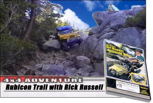
Information about the Rubicon Trail from El Dorado County, California
Credit: Reprinted with permission by County of El Dorado
Location
The Rubicon Trail is located in the California High Sierra, west of Lake Tahoe, approximately 80 miles east of Sacramento and 35 miles east of Placerville. This world-renowned 4-wheel-drive route runs from Georgetown (near Highway 49) to Tahoma at Lake Tahoe, covering roughly 22 miles. The trail crosses El Dorado and Placer Counties, passing through Eldorado National Forest and sections of private land.
Elevations range from about 5,400 feet to more than 7,000 feet. The Georgetown to Wentworth Springs section is a maintained road, while the OHV trail begins near Loon Lake. Most visitors start at Loon Lake, accessible from U.S. Highway 50. The Loon Lake to Tahoe segment is about 12 miles long and winds through rugged granite terrain typical of the Sierra Nevada.
History
Originally a Native American route between the Sacramento Valley and Lake Tahoe, the Rubicon Trail was rediscovered by European settlers in the 1840s. By the 1890s, it had become a rough wagon road leading to the Rubicon Mineral Springs Resort and Hotel. The first automobile reached Rubicon Springs in 1908, driven by a woman from Lake Tahoe, earning significant attention in San Francisco newspapers.
During the 1920s, the road was promoted as the best route from Georgetown to Lake Tahoe. A publicity caravan was organized, complete with newspaper coverage and plans for road improvements. When the Rubicon Springs Hotel closed in the late 1920s, the road fell into disuse. By the early 1950s, 4-wheel-drive enthusiasts had adopted the route, and it has since become one of the most famous OHV trails in the world.
The Current Trail
Although the modern trail follows the historic route from Wentworth Springs to Rubicon Springs, erosion and vehicle traffic cause minor changes each season. Unique granite formations help identify the original path in historic photos. The trail also crosses a PG&E spillway built in the 1930s and 1940s.
The Rubicon Trail is widely regarded as the premier OHV route in the United States. Once considered a "10 out of 10" in difficulty, improvements and bypasses have made some sections more manageable, though it remains a challenging trail requiring high-clearance, short-wheelbase vehicles with proper armor.
The trail attracts both street-legal and green-sticker OHVs, including dirt bikes, ATVs, and purpose-built rock crawlers. Because it borders the Desolation Wilderness, the trail also serves as an access point for hikers and backpackers.
| 4 Wheeler's Guides to the Rubicon Trail 
|
The Rubicon Trail is not for beginners or low-clearance vehicles, but it remains a bucket-list destination for off-roaders worldwide. This legendary 22-mile route near Lake Tahoe's West Shore challenges drivers with granite, boulders, and steep climbs. Each year, thousands of enthusiasts attempt the Rubicon to earn the right to say they completed it. Events such as the annual Jeep Jamboree continue to draw large crowds, celebrating the trail's history and difficulty. With proper preparation, skill, and a capable vehicle, you can experience one of the most iconic OHV routes in the world.
|

The ceremonial trailhead is in Georgetown, a Gold Country community whose economy benefits from Rubicon visitors. The trail is typically run west to east (east to west is known as "running backwards"). The western end has two trailheads: the true trailhead at Wentworth Springs Campground and the more popular Loon Lake trailhead. These routes meet at Ellis Creek, about one mile from each starting point.
The Wentworth Springs route begins with a steep climb before leveling into a technical approach to Ellis Creek. The Loon Lake route is more moderate, beginning at the spillway below the second dam and passing through the Granite Bowl before reaching Ellis Creek. From there, the trail continues toward Walker Hill.
Walker Hill is a steep, rocky ascent divided into three sections: a lower boulder field with a sharp right turn, a middle section with a left turn over extremely rough terrain, and an upper "sandstone" section of decomposed rock. A small timbered clearing at the top offers a brief rest before the trail continues toward the Little Sluice.
The Little Sluice, once considered the most difficult part of the Rubicon, is a short but boulder-filled obstacle. Many drivers pause afterward near Spider Lake (closed to OHV access), a scenic alpine lake just south of the trail. From here, the trail climbs to a granite overlook above Rubicon Valley and Buck Island Reservoir. The trail then splits: Granite Slab to the left and Old Sluice to the right.
The Granite Slab route is more scenic and generally faster. It descends a broad granite face before rejoining the Old Sluice route about half a mile before Buck Island Reservoir.
The Old Sluice route is more difficult and follows a historic section of the original trail. It begins with the Chappie Rock drop-off, then continues along a narrow mountainside path before descending steeply into the Old Sluice.
The two routes merge just below the Old Sluice. From there, the trail crosses the dam at Buck Island Reservoir, skirts the eastern shoreline, and climbs over a low pass before descending into the Big Sluice.
The Big Sluice is a long, rocky downhill traverse along the mountainside. Despite its name, it is not a true sluice, but it remains one of the most iconic and challenging sections of the trail.
After the Big Sluice, the trail crosses a bridge over the Rubicon River and enters Rubicon Valley. It passes through Rubicon Springs, continues beyond the El Dorado County line, and enters Placer County.
The Rubicon Trail is actively maintained. Since 2009, El Dorado County and California State Parks have implemented erosion control, trail stabilization, and safety improvements. The Board of Supervisors formally adopted the surveyed trail alignment in 2010. The county and the Rubicon Trail Foundation continue to provide signage, maps, and education to help visitors stay on the designated route. Law enforcement presence has increased to ensure compliance with OHV regulations.
Visitors to this page like Teltek USA Auto Thermometer
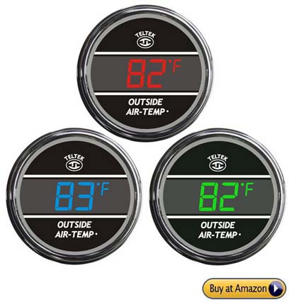
This Teltek USA Auto Thermometer for Any Semi, Pickup Truck or Car is a popular choice for drivers in the know. The Truck and Auto Thermometer Gauge accurately displays the temperature inside or outside (one or the other) of your car, truck or semi. Users say, "It's USA made and extremely well built. It's very accurate and reliable for many years." We thank our readers for letting us know about this auto thermometer, because we found one on Amazon, and we are super glad to have this Teltek Auto Thermometer for our RV.
Important Phone Numbers for Off-Roading at Tahoe
- Foresthill OHV Area - Phone: (530) 367-2224
- Sierraville Ranger District - Phone: (530) 994-3401
- Nevada City Ranger District - Phone: (530) 265-4531
- Fordyce Jeep Trail (Tahoe National Forest) - Phone: (530) 265-4531
- Truckee Ranger District - Phone: (530) 587-3558
- Downieville Ranger District - Phone: (530) 362-8259
- Prosser Hills Area (Truckee Ranger District) - Phone: (530) 587-3558
Enjoy Your Off-Roading at Tahoe
We hope you have enjoyed this page in our activities guide to Lake Tahoe, the High Sierras and Northern Nevada. We have enjoyed the trails at Tahoe and all over the High Sierras for many years! This is why we're super happy to tell you that this off-roading at Lake Tahoe page is our most popular page! Please support our Lake Tahoe website by patronizong our sponsors when looking for Tahoe lodging or other products. Thank you for visiting and enjoy your off-roading at Lake Tahoe and Beyond!
More Tahoe Activities: Skiing & Snowboarding
|
|